
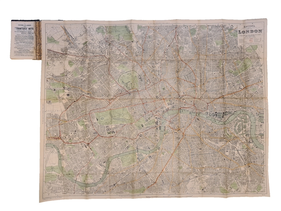
HAND-COLOURED MAP OF LONDON
BACON, [George Washington.]
Bacon's New Map of London, Divided into half mile squares and circles. From Charing Cross. Scale Four Inches to the Mile.
London, Bacon, [No date, but later half of 19th century].
Hand coloured folding map of London (102 x 79) . The map is printed on paper, mounted on linen and folds between publisher's original cloth boards with title in gilt lettering to front board. Advertisement for 'Chas. Baker & Co.' to inside of upper cover and Guide Book and Index (62 pp). Wear to text and a few leaves detached. Boards and map fine and clean.
Order-nr.: 59727
DKK 1.200,00