
ATLAS BELGIQUE - ATLAS BELGIUM - LOUIS CAPITAINE.
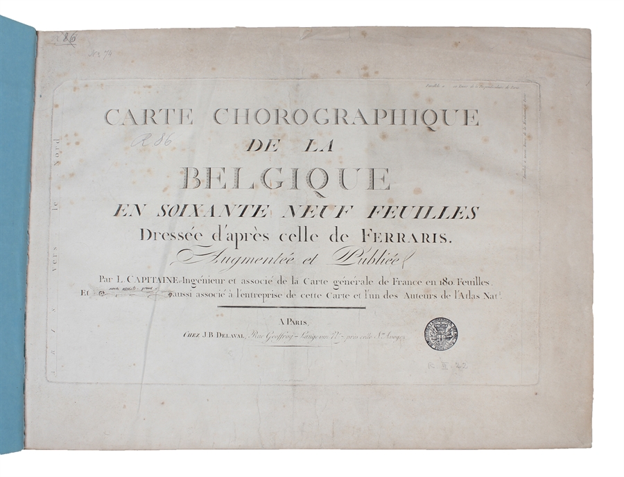
Carte Chorographique de la Belgique en soixante neuf Feuilles dressée d'après celle de Ferraris. Augmentée et Publiée par L. Capitaine... et associé de la Carte générale de France en 180. Feuilles. Et (P.G. Chanlaire) aussi associe´ a` l'entreprise de cette carte et l'un des Auteurs de l'Atlas Nat[iona]l.
Paris, J.B. Delaval, (1796/97). Folio-oblong. (40 x 55 cm.). Contemp. modest hcalf. A paperlabel pasted on upper part of spine. Marbled paper on covers. A stamp on title-page. Engraved title-page and engraved Tableau (dated AN V). With 67 engraved maps (incl. Tableau, numb. (1)-65 + 53 bis and 58 bis). On title-page the name P.G. Chanlaire is erased. Engraved title-page slightly soiled, Tableau, the first and last map a bit brownspotted and last map with a closed marginal tear, otherwise clean.
The atlas is based on the survey carried out by Count Joseph Ferraris in the late 1760s. On the "Tableau d'Assemblage" the last map concerning Belgium is no. 65 (Luxembourg) and also the last map here, not in accordance with the mentioning of 69 on the title-page.
According to Shirley "Maps in the Atlases of the British Library" (T.CAP-1a) the atlas should include 4 sheets covering Belgium on a smaller scale (numb. 66-69), they are not present here, but having all the regional maps.
Order-nr.: 55711
DKK 15.000,00