
SPANISH MARITIME ATLAS - (LØVENØRN, POUL de).
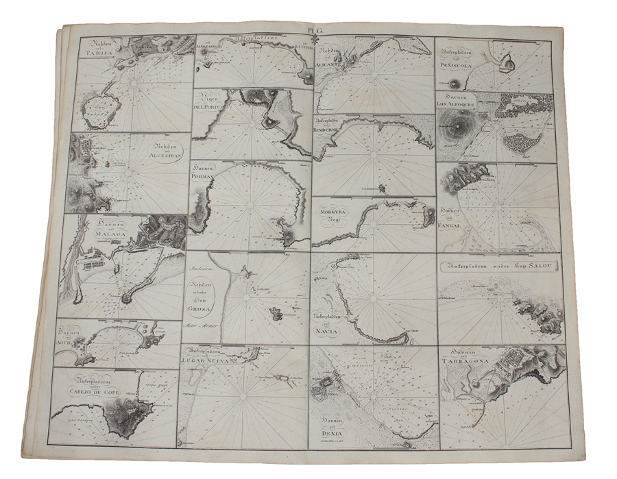
Samling af Kaart over Havne og Ankerpladse, tilligemed Fortoninger, henhörende til Beskrivelsen, over den spanske og portugisiske Kyst. Udgivet fra (Søkort-Archivet).
(København), 1819. Folio. (44 x 27 cm.). Original blue wrappers with some dampstains and rear somewhat soiled. With the engraved oval title on upper wrapper. In a later hcloth portfolio. With 19 (all) engraved maps, charts, plans, coastal profiles of which 7 are double-page. (Maps numbered in letters A-K, profiles numbered I-IX).The maps depicting the main harbours (with townplans) and anchorages. Maps with a few small marginal closed tears.
Extremely scarce Danish edition, a compilation from Vicente Tofino's "Atlas Maritimo", where the sheets have Danish text. This maritime-atlas was probably intended to accompagny Løvenørn's "Beskrivelse til det voxende Kaart over Kysterne af Spanien og Portugal....", 1818.
Bibl. Danica II, 362 a. 367. - Luisa Martín-Merás: Catálogo analítico de los Atlas del Museo Naval de Madrid, 2007". No 232.
Order-nr.: 56069
DKK 7.500,00