

Brussels, 1712.
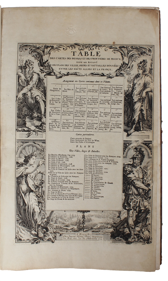
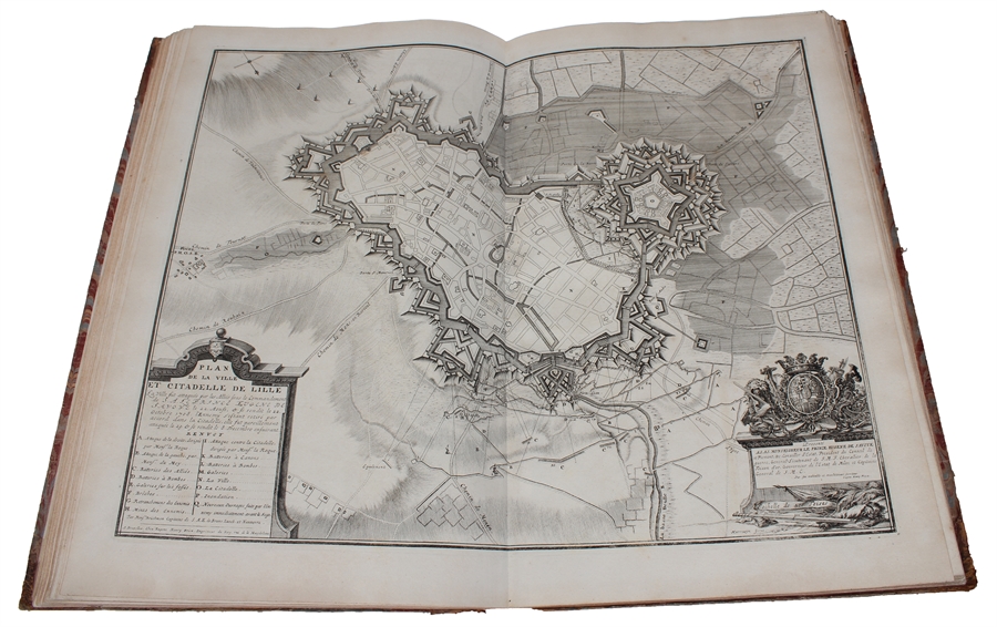
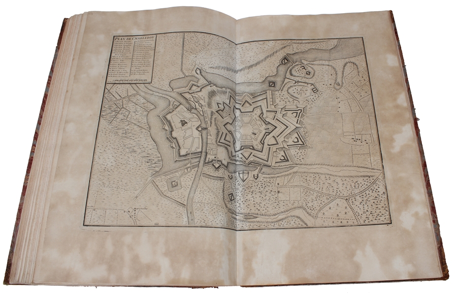
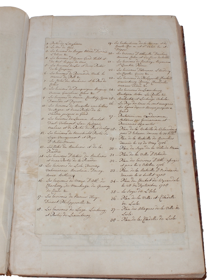
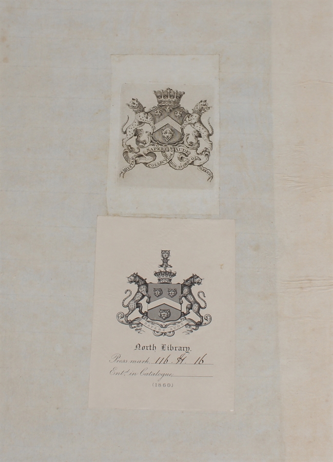
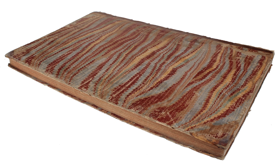
Folio (512 x 315 mm). In contemporary half calf with seven raised bands. Spine and hindges with wear. Leather brittle and upper and lower 10 cm hindges detached. Two library labels pasted on to pasted down front end-paper. Upper margin of first three leaves blind-stamped. Handwritten (19th century hand) index mounted in on verso of first map and each map numbered. With 75 maps and plans, many double-page or folding: 24 cartes des Pays Bas, Carte générale de Brabant, Carte du Pays de Waes, Carte des Postes d'Allemagne, 48 plans des Villes, Sièges & Batailles (complete). 3 maps with minor marginal tear (outside plate), 2 with minor split to lower part of middle folding. A few maps at end with browning. A few plates (primarily 61, 50, 33, 25) heavily trimmed with slight loss to upper margin. An overall fine and clean copy.
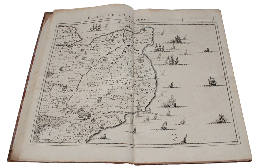
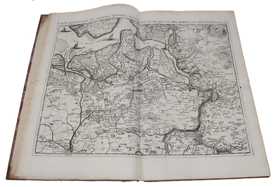
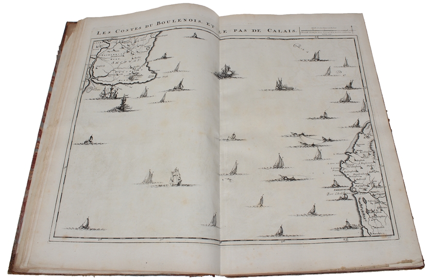
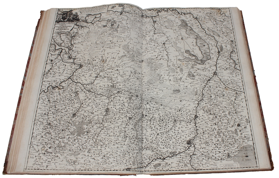
First edition of Fricx’s famous atlas consisting of topographical maps, plans of towns, fortresses, sieges and battlefields. Today Fricx is considered one of the most important map publishers in the Southern Netherlands in the 18th century. This collection of maps and plans of fortifications is also known under the title ‘Recueil des cartes des provinces meridionales des Pays Bas et des frontiers de la France. The first 24 maps form together a topographical maps of the Southern Netherlands, scale 1:115.000. Most of the plates were engraved by Jacob Harrewijn. These maps were based on military maps by French engineers and show an accurate representation of the topography. The importance of the map of the Spanish Netherlands is demonstrated by the fact that the 24 sheets were copied in Paris, Augsburg, and Amsterdam. The maps were also published separately. “The bookseller and printer, Eugéne Henri Fricx, was one of the most important map publishers of the Southern Netherlands in the 18th century. He lived in Brussels where he had his shop on Rue de la Madeleine. His activities in the field started in 1706 with the production of military plans of battles and sieges of the War of Succession. In the same year,he also stated the publication of the map of the Southern Netherlands in 24 sheets; it was finished in 1712, apart from the sheet Luxemborg, which was engraved in 1727. He employed Jean Harrewijn of Brussels as an engraver and Cornelis Marke of Middelburg as a contractor for the ‘enluminators’. Although he had children, his business was not continued after his death (about 1740). His map of the Southern Netherlands was copied by Covens & Mortier and sold until ca. 1780, when it was replaced by Ferraris’ Map of the Austrian Netherlands.” (Koeman II, Fri1) Koeman II, Fri1
Order-nr.: 60165